

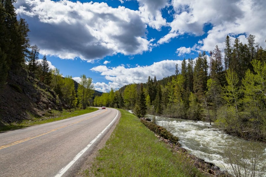
Spring transforms the landscape around Great Falls into a driver's paradise. As temperatures climb from March's average of 43.3°F to April's milder 52.3°F, the region awakens with snowmelt-fed rivers, emerging wildlife, and accessible roads that winter keeps locked away. Sure, some high-elevation routes won't fully open until late May, but several scenic drives near Great Falls, MT offer excellent spring exploration right now.
The combination of longer daylight hours, lighter traffic than summer, and dramatic seasonal transitions makes this the perfect window for discovering Montana's diverse terrain from river valleys to mountain passes.
Why Spring Is Perfect for Scenic Drives Near Great Falls, MT
Spring driving in Montana delivers unique advantages. Increasing rainfall from March through May keeps landscapes green and rivers running high, creating powerful cascades. Wildlife becomes more active as animals emerge from winter dormancy, giving you better chances to spot deer, elk, and migratory birds. Variable conditions add drama while keeping crowds manageable.
But spring demands flexibility. Road access varies significantly by elevation, with lower-altitude routes opening weeks before mountain passes. Checking current conditions before you head out ensures you can adjust your plans when Mother Nature has other ideas.
Kings Hill Scenic Byway: Mountain Views and Waterfall Access
This 71-mile route requires about two hours of driving time (one way), though you'll want to budget more for stops. Trust us on that one. The byway stretches from Great Falls through the Little Belt Mountains, connecting the mountain towns of Monarch and Neihart before reaching White Sulphur Springs. The route combines paved highways with gravel sections, offering access to high-country views that shift dramatically as you gain elevation toward Kings Hill Pass.
Spring transforms this drive into a waterfall showcase. Snowmelt courses down mountain faces, creating temporary cascades that won't exist by midsummer. A vehicle with decent ground clearance helps for side explorations on gravel sections, though you don't need anything extreme.
Key Viewpoints and Spring Road Conditions
Several pullouts along the byway provide panoramic mountain vistas without requiring hiking. The pass area itself offers sweeping views across forested valleys and distant peaks. Spring conditions here change rapidly (a warm morning can shift to snow flurries by afternoon, particularly through April). Highway maintenance crews work steadily to clear winter debris, but expect wildlife crossings, especially during dawn and dusk hours.
The length and variable weather mean you should prepare with layers, water, and flexible timing. The weather here has a mind of its own.
Missouri River Recreation Road: An Easy River Valley Drive
For a gentler option closer to town, the Missouri River Recreation Road delivers river scenery without demanding mountain driving. This route follows the Missouri River valley, offering multiple access points to attractions like Giant Springs State Park, where one of the country's largest freshwater springs pumps 156 million gallons daily through crystal-clear pools.
The road connects to Ryan Dam, where a suspension bridge leads to Ryan Island Park. Spring snowmelt makes the cascades particularly powerful as water volume peaks. You can also access the River's Edge Trail, a nearly 60-mile paved and single-track system following the Missouri River through town and connecting downtown areas with parks and natural spaces.
Sun River Canyon Drive: Close-In Wilderness Experience
Heading west from Great Falls, the Sun River Canyon route provides quick access to rugged Rocky Mountain Front country. This drive connects to the Gibson Reservoir area via a 200-mile loop that takes approximately four hours and five minutes, combining paved highways with gravel forest roads. The route showcases the dramatic transition from prairie to mountains, with the Rocky Mountain Front rising abruptly from the plains like something out of a painting.
Spring here means active wildlife as bears emerge and migratory birds return. Area rivers and feeder streams run high with snowmelt, adding sound and movement to the landscape. The canyon section offers particularly striking views as the road winds through rocky terrain with the Sun River carving its path below.
While the distance rivals Kings Hill Scenic Byway, this route feels more remote. Gravel sections demand attention, particularly when wet, and you'll encounter fewer services. That remoteness delivers a true wilderness experience within a half-day's reach.
Tower Rock State Park and the Lewis and Clark Trail
Historical significance meets natural beauty along the 138-mile Lewis and Clark Historical Trek, which takes roughly two hours and sixteen minutes of paved driving. This route retraces portions of the expedition's path, connecting high plains to river valleys.
Tower Rock State Park provides hiking access and unique geological features that break the prairie skyline. The rock formation served as a landmark for indigenous peoples and later for Lewis and Clark's party. Spring makes the trails accessible without summer heat, which can be brutal here.
The Lewis and Clark National Historic Trail Interpretive Center at 4201 Giant Springs Road anchors the historical experience with a two-story diorama of the five waterfalls of the Missouri River. Admission costs $8 for adults while children 15 and under enter free.
For wildlife viewing, consider extending to Benton Lake National Wildlife Refuge, located 12 miles north of Great Falls. The refuge's 12,383 acres include a 9-mile gravel Prairie Marsh Wildlife Drive where spring brings peak bird activity as migratory species return. It's worth the extra miles.
Planning Your Spring Scenic Drive Near Great Falls
Successful spring drives around Great Falls start with realistic expectations about conditions and timing. Most high-elevation scenic roads remain snowed in through spring, with full access typically arriving in late May or June. Visit Great Falls Montana provides current road conditions and seasonal updates that can save you from driving to a closed gate.
Pack layers for rapidly changing weather, particularly on longer routes. April nighttime temperatures can still drop to 34.9°F, meaning morning drives start cold even when afternoons warm up. Water, snacks, and a full fuel tank matter more on remote routes where services are scarce.
Before heading out, ensuring your vehicle is ready for spring adventures helps prevent roadside issues. A quick check of tires, fluids, and lights takes minutes but makes a difference on variable spring roads with mud, gravel, occasional snow, and increased wildlife activity.
These scenic drives showcase why Great Falls serves as the perfect base for exploring Montana's diverse landscapes. Whether you choose the challenging mountain byways or gentler river valley routes, spring offers unique viewing opportunities that summer and fall can't match. The season rewards those who time it right with uncrowded roads and landscapes in transition.